


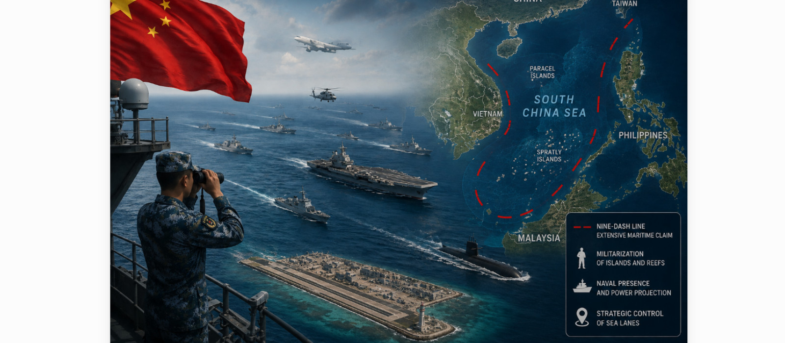


China’s actions in the South China Sea (SCS) offer a fascinating study in the evolution of its maritime strategy over the past 70 years, as also a pointer to its future evolution. A land-locked and relatively shallow sea, the SCS contains more than two hundred small islands, rocks and coral reefs, only about three dozen of which are permanently above water. Connecting the Western Pacific to the Indian Ocean, it is an enclosed sea where a significant number of global sea routes coalesce. The Malacca, Sunda, Lombok and Makassar Straits link the SCS to the Indian Ocean, through which passes more than half the annual global merchant traffic in tonnage and a third of all maritime traffic worldwide, comprising an approximate value of $3.37 trillion. The most important commodity transported through this region is oil to East Asia, catering mainly for the energy needs of China, Japan and South Korea. Connectivity of the SCS to the Pacific Ocean is equally restrictive, being largely through the Luzon and Taiwan Straits.
The SCS is assessed to have a rich trove of mineral and non-mineral resources with estimates of 11-12 billion barrels of oil and 190 trillion cubic feet of natural gas, mostly along the margins of the sea, with very little reserves estimated under the disputed islets and reefs. A substantial amount of money has been invested by stake-holder nations in oil and gas exploration, with the China National Offshore Oil Corporation (CNOC) alone having invested $20 billion. This is also one of the most fished waters and, according to some accounts, amounts to 10% of the total global production, with catch now dropping because of over-fishing and environmental degradation. In fact, since 1999, China enforces an annual fishing ban between 01 May and 16 August up to the 12th Parallel, which includes the Spratly and Paracel Islands, and can be seen as another way of enforcing its sovereignty over the SCS.
The SCS, therefore, occupies immense geostrategic and economic importance for both East Asian and Southeast Asian countries, most of them being either enclosed or fronted by this water body. The SCS is also mired in territorial disputes. While China and Taiwan lay historic claim to more than 80% of the SCS, Vietnam claims full sovereignty over the Paracel and Spratly Islands; Philippines asserts ownership of the Spratly archipelago and the Scarborough Shoal; Brunei and Malaysia claim sovereignty over the southern parts of the sea and some of the Spratly Islands; and Indonesia contests the nine-dash map as it impinges on the Exclusive Economic Zone (EEZ) accruing to it from its Natuna Islands, which lie outside the nine-dash line (see Fig1). USA and India, along with other maritime nations across the globe, do not officially align with any of the claimants, but propagate freedom of navigation and over-flight in the SCS, and settlement of the conflicting claims in accordance with United Nations Convention on the Law of the Sea (UNCLOS). While all claimant countries have taken pro-active actions to occupy various islands in the SCS, China has used its growing maritime power to obtain a stranglehold over a large part of the sea.

Fig 1: Claims of Competing Parties in the South China Sea1
At the centre of China’s claims in the SCS is a dashed line map drawn in the 1940s, claimed by Beijing to be a ‘historic line’ (but without exact coordinates), which encompasses the heart of the entire SCS in a loop extending 1,200 miles southwards from China’s Hainan Island, close off the coasts of Singapore, Indonesia and Malaysia, and enclosing all the island groups in the sea.2 Despite its ‘ancient and historic claims’ over the islands in the SCS, the first modern record of Chinese presence dates only to December 1946, when two Chinese ships dropped a landing party on the island of Itu Aba in the Spratly archipelago. It was after this voyage that the former Government of the Republic of China (ROC) formally claimed sovereignty over the islands.3 The first official Chinese government map of the SCS with a revised list of Chinese names titled the ‘Map of the South China Sea Islands’ containing 11 dashes (as in Fig 2), comprising almost the entire SCS, was published in 1948 by the ROC before the Communist victory in China.5 The 11 dashes were reduced to the current nine dashes by the People’s Republic of China (PRC) in the early 1950s, to bypass the Gulf of Tonkin, as a courtesy to the Communist government in Vietnam.

Fig 2: China’s 11-dash Map of Claims in the South China Sea (1948)4
After the establishment of the PRC, China became acutely aware of its disadvantage in maritime geography due to its coastline being enclosed by island chains, which limited its free access to the oceans. Its limited natural resources and arable land, combined with a large population, also meant that it was dependent on imports for critical commodities. These shortfalls played a central role in shaping China’s ‘island-grabbing’ and ‘island-building’ spree in the SCS, in pursuance of the People’s Liberation Army’s (PLA) primary mission of ‘re-unification of the motherland.’ From 1949 till 1980, China followed a military strategy of Active Defence and a maritime strategy of Near Coast Defence, which limited the PLA Navy (PLAN) mainly to brown water operations, but included plans to gain control of islands close off its coast held by ROC forces (based on Taiwan), which the PRC apprehended could be used as a springboard to attack the mainland. The conquest of Hainan Island in 1950 was the first operation, with the island being quickly transformed into a major naval base with an airstrip. After almost 25 years of consolidating its presence on Hainan, China used the opportune moment of the drawdown of US forces in South Vietnam, after the 1973 Paris Peace Accords, to occupy the western half of the Paracel Islands in 1974 (China already controlled the eastern group, the Amphitrite Islands). Hainan Island was the staging base for the maritime and air forces used to enforce the occupation against the hapless South Vietnamese Navy. After occupying the Paracel Islands, the PLAN built a naval base and runway on Woody Island, one of the larger islands of the Paracel Group, to extend its reach into the SCS.
In 1977, after Mao’s demise, China’s attention under Deng Xiaoping was slowly but surely turning towards the seas. The military strategy of Active Defence was modified to Active Defence in the New Era in 1980, with the maritime component of this strategy being termed as Near Seas Active Defence. Revision of China’s Military Strategic Guideline (MSG) from total war to local/ limited wars in 1985 was the first time that the PLAN and China’s maritime dimension received significant attention, prompted by its growing recognition that if China was to become an economic superpower, it would also need to be a maritime power. A significant event at this juncture, which played a major role in re-shaping China’s maritime strategy, was the successful conclusion of the third and final United Nations Conference on UNCLOS on 10 December 1982. The realisation of the advantage that UNCLOS conferred, with regard to rights and responsibilities within EEZ and continental shelves, spurred the race for China and other Southeast Asian nations to claim or occupy contested islands in the SCS. Consequent to the shift to the maritime strategy of Near Seas Active Defence, timelines for achieving sea control over defined oceanic areas were set out by Admiral Liu Huaquing in three phases - the ocean area from China’s coast to the so-called ‘first island chain’ in Phase 1 by 2000; extended till the so-called ‘second island chain’ in Phase 2 by 2020; and finally over vast oceanic expanses in Phase 3 by 2050 (see Fig 3).

Fig 3: The First and Second Island Chains and Maritime Chokepoints in the South China Sea6
Admiral Huaqing enumerated six maritime objectives that formed the core of strategy of near seas active defence, which became the primary missions of the PLAN - reunify Taiwan; enable the return of lost and disputed maritime territories in the ‘first island chain;’ defend national maritime resources; secure Sea Lines of Communication (SLOC); preferably preclude, but if necessary defeat decisively any seaborne attack on China; and build sufficient strategic deterrence.7 While the new strategy was essentially one of sea denial, it simultaneously aimed at sea control within the ‘first island chain’ with the strategic maritime objective of ensuring that China would not be denied access to its near seas and protected what it perceived as its sovereign maritime rights.
China commenced the next phase of its encroachments (after 1974) in the SCS from the Spratly Islands by occupying the Fiery Cross Reef in January 1987, which culminated in a bloody clash with the Vietnamese Navy on 14 March 1988, when the PLAN sank three of their ships and killed 74 Vietnamese sailors. Towards end 1988, China occupied Mischief Reef, well within the Philippines EEZ after another bloody clash, this time with Philippine forces. Chinese assertiveness over its claims accelerated after the end of the Cold War and coincided with its economic blossoming, which fed the double-digit growth in its military (especially naval) expenditure.
In February 1992, to implement the Law of the Sea at the domestic level, China enacted its Law of the People’s Republic of China Concerning the Territorial Sea and the Contiguous Zone of 1992, which defined the PRC’s territorial sea expansively to include areas covering Taiwan and all its islands, Macclesfield Bank, Diaoyu (Senkaku), Paracel, Spratly and all other islands claimed by China. The 1993 MSG, Winning Local Wars under High-technology Conditions, identified Taiwan and USA as China’s strategic opponents (as against the Soviet Union earlier). The East Coast of China became the primary sector of threat, which required dependence on maritime power. In 1994-95, China started permanent construction on Mischief Reef, which it had forcibly occupied in 1988. A watershed year was 1997, as the peaceful transfer of Hong Kong from UK to China removed a potent ‘threat’ from democratic forces close to its mainland, and was a major step in China’s quest to restore ‘lost territories’ to the motherland.
During Hu Jintao’s leadership from 2002 to 2012, foreign policy moved from ‘peaceful rise’ to ‘peaceful development,’ which implied continued focus on its economic growth but a more proactive international leadership role by China.8 An outcome of this approach was the signing of the ASEAN-China Declaration of the Conduct of Parties in the South China Sea (DOC) in November 2002, which sought to ease tensions and promulgate guidelines for conflict resolution. This was the first time that China accepted a multilateral approach on the SCS issue. However, this was to prove a diplomatic ploy, designed to exclude USA from intruding into the discussions and, after a brief hiatus, China resumed its piratical behaviour through its time-trusted strategy of ‘creeping encroachment.’
The 2004 MSG, Winning Local Wars under Conditions of Informationisation, identified USA as the strategic opponent and China began deploying disruptive technologies and forces, clearly evident as an Anti-Access/ Area Denial (A2/AD) strategy, to make the SCS a ‘Chinese lake.’ The SCS was labelled as a ‘core interest’ by China in 2010, a year in which China also became the biggest energy consumer in the world, highlighting its dependence on the seas. September 2010 and the first half of 2011 witnessed Sino-Japanese clashes over the intrusion of Chinese fishing boats into waters off the Senkaku Islands; a series of incursions by Chinese ships into Philippine waters near the Spratly Islands, Reed Bank and Amy Douglas Bank off Palawan Island; and harassment of Vietnamese oil exploration ships in the SCS. Tensions exacerbated when the Philippines renamed the SCS as the ‘West Philippine Sea’ in 2011.
The year 2012 marked the ascent of Xi Jinping. He perceptibly shifted from a policy of ‘peaceful rise’ to a more assertive and aggressive posture, exemplified by the April 2012 incident between China and the Philippines over the Scarborough Shoal. Starting as an uneasy stand-off between the Philippine Navy and two unarmed China Marine Surveillance (CMS) craft shepherding Chinese fishermen (maritime militia) in the shoal, the escalation led to China establishing a permanent presence in the area by July 2012. This led to the Philippines filing for international arbitration under UNCLOS on 22 January 2013. Meanwhile, in June 2012, Vietnam passed a law asserting its sovereignty over the Paracel and Spratly Islands. In response, China announced the establishment of Sansha city on the Paracels, which would administer the Paracels, Spratlys and Macclesfield Bank. China also upgraded the SCS to a ‘core interest’ alongside Taiwan and Tibet, which implied that it was ready to fight over it with other countries.
Discord between ASEAN nations on the SCS issue peaked when, for the first time, ASEAN failed to release its official communiqué after its annual summit in July 2012, as Cambodia opposed the move to include the dispute in the statement due to Chinese influence. Meanwhile, after Japan purchased three of the five Senkaku Islands from its private Japanese owner in September 2012 for $26 million, China declared territorial sea baselines around the islands and submitted a claim over the islands to the UN in January 2013. The tensions, by now, had resulted in the increase of naval budgets across the region, with China leading the table. Not coincidentally, China’s first aircraft carrier was also commissioned on 25 September 2012. In November 2013, China declared an Air Defence Identification Zone (ADIZ) over the East China Sea, including the Senkaku Islands, requiring all non-commercial air traffic to submit flight plans prior to entering the zone, without which China could take military action against unidentified aircraft. This has resulted in intensified military air activity over the region. As a consequence, for the first time, USA clearly stated that the Senkaku Islands were covered under the ambit of the US-Japan Mutual Defence Treaty. In 2013, China also turned its attention towards the Second Thomas Shoal (105 nautical miles west of the Philippine Island of Palawan in the Spratlys), though the Philippines managed to hold on to the shoal with US assistance.
From 2014 onwards, China started massive land reclamation and construction on seven of its existing outposts in the Spratly Islands, building artificial islands and military facilities on Fiery Cross (see Fig 4), Cuarteron, Gaven, Hughes, Johnson, Mischief and Subi reefs. By August 2015, a US Department of Defence report estimated that China had reclaimed over 3,000 acres of land on the Spratlys. These outposts provide maritime domain awareness capabilities across the SCS and serve as springboards to extend China’s reach even further into Southeast Asia, the Pacific and the Indian Ocean.9 Another impact of China’s threatening moves was the signing of a new Enhanced Defence Cooperation Agreement between USA and Philippines on 28 April 2014. In May 2014, tensions between China and Vietnam again escalated to a maritime brawl involving the collision of several ships over the presence of a Chinese oil rig near the Paracel Islands, which was ultimately withdrawn by China, but not before bilateral relations had plunged to a new low. An ironic consequence was the partial withdrawal of the US weapons embargo on Vietnam, which had been in place since the end of the Vietnam War in 1975, in which China and the Vietnamese Communist regime had been close allies.

 Fig 4: Fiery Cross Reef after Reclamation, 27 March 202010
The 2015 MSG, which revised China’s military strategy to Winning Informationised Local Wars, Highlighting Maritime Military Struggle, maintained USA as China’s strategic opponent and focussed on maritime preparations to counter the threat.11 China’s maritime strategy was clearly enunciated in this paper stating, “in line with the strategic requirement of offshore water defence and open seas protection, the PLAN would gradually shift its focus from offshore waters defence to the combination of offshore waters defence with open seas protection.”12 This indicated China’s intention to move outwards to the ‘open seas’ with the awareness that it’s ‘near seas’(within the ‘first island chain’) were now secure. In 2015, President Xi Jinping had promised that China would not militarise the SCS islands and that only ‘necessary defence facilities’ would be built for ‘maritime safety and natural disaster support.’ However, commencing February 2016, China deployed surface-to-air missiles, J-11 fighters and H-6J bombers on Woody Island in the Paracels, which could potentially target the entire Philippines archipelago (see Fig 5).

Fig 5: Range Arcs Depicting Potential Coverage of HQ-9 SAMs, YJ-62 ASCMs, and DF-21 Ballistic Missiles from China’s Larger South China Sea Island Bases13
By 2019, China had deployed an array of air defence systems, laid an ‘Underwater Great Wall’ to detect enemy submarines, and built berthing, refuelling and arming facilities for ships and aircraft on the islands it controlled or had reclaimed. This led to the US Navy and other navies, such as UK’s Royal Navy and the Royal Australian Navy, intensifying ‘Freedom of Navigation’ operations (FONOPS) in the SCS, which have resulted in incidents such as a near collision between a US Navy destroyer and a PLAN ship in September 2018. Thus far, the US Navy has conducted almost 40 FONOPS in the SCS since 2015, by sailing US Navy ships within 12 nautical miles of artificial islands claimed or occupied by China.
Meanwhile, in a major set-back to China’s efforts at ‘lawfare,’ the International Tribunal at The Hague ruled in favour of the Philippines, on 12 July 2016, in the case that had challenged China’s territorial claims in the SCS. The verdict categorically ruled that China’s nine-dash line had no legal basis for its ‘historical claims,’ and that none of the islands fit requirements under UNCLOS to generate a 200 nautical mile EEZ, as they had been reclaimed. It also mentioned that China had broken international law by endangering Philippine ships and damaged the marine environment. While China boycotted the proceedings and ignored the verdict, saying that the tribunal had no jurisdiction on the issue, the decision finally opened the door for individual ASEAN countries to openly reject China’s exaggerated maritime claims. They had, thus far, hesitated to take the lead in speaking out for fear of earning China’s ire.
In response to the set-back, China moved quickly to reassure Southeast Asian countries of its ‘peaceful’ designs by engaging in negotiation processes at two levels - first by negotiating with ASEAN for framing a Code of Conduct (COC) in the SCS, with both sides agreeing to a framework on COC on 18 May 2017 aiming to reach an agreement by 2021; and, secondly, by negotiating separately with the countries with which it had territorial disputes at sea.14 But, this again proved to be a diversionary tactic as, in April 2019, Chinese ships commenced harassing the Philippine-held Thitu Island in the Spratlys to prevent landing of material to repair its airfield. Malaysia also submitted the remaining portion of its continental shelf claim in the northern part of the SCS to the UN’s Commission on the Limits of the Continental Shelf (CLCS), which was a continuation of the joint submission made by Malaysia and Vietnam for the southern portion of the SCS in May 2009, and de facto challenged China’s maritime claims in the SCS.15
China’s confidence in its control over the SCS was reinforced by the 2019 White Paper, in which it claimed inalienable sovereignty over the region and stated that the sovereignty of only a few islands and reefs, and their maritime boundary demarcation, remained outstanding. In the wake of the Covid-19 crisis, tensions in the SCS have escalated in 2020, with China taking aggressive action against a Philippine warship and a Malaysian drill ship, sinking a Vietnamese fishing boat near the Paracels, deploying its survey ships in the EEZ of Vietnam and Malaysia, and announcing two new administrative districts covering the Spratly and Paracel Islands. In April 2020, China continued its aggression through cartography by giving new names to 80 geographical features in the SCS; and, on 20 June 2020, in response to the move by Japan’s Okinawa Assembly to re-name the administrative area governing the Senkaku Islands, China’s Ministry of Natural Resources promulgated the coordinates and Mandarin names of 50 underwater features in the East China Sea.16
In sum, it is evident that China’s aim of achieving sea control in the waters enclosed by the ‘first island chain’ by the year 2000 has been substantially achieved, albeit after a delay of about 20 years. Using a clever mix of raw military power against weaker adversaries; economic inducements to buy allies or break alliances; grey zone operations to restrict use of the sea by other littorals; diplomatic ploys and subterfuges, such as the simultaneous push through the COC, to gain a veto right over joint military exercises between claimants and countries from outside the region, as well as an outright ban on cooperation with extra-regional countries on oil and gas, China has clearly out-manoeuvred its principal opponent, USA, in the SCS. By consolidating its control over several disputed features in the SCS, China has significantly reduced the vulnerability of its coast from seaward attack, and its vulnerability to maritime interdiction/ blockade during a crisis, by complicating a possible strategy of ‘offshore control’ by USA.17
The creation of runways, naval bases and logistics depots in the SCS enables China to project power closer to all three of the major Southeast Asian straits. The island bases also greatly increase the space monitored by early warning systems, facilitate easier tracking of potential targets, and offer dispersed havens for warships and aircraft in support of China’s A2/AD strategy, by threatening significant military costs on any adversary within 1,000 nautical miles off the Chinese coast and complicating US efforts to support Taiwan in case of a military conflict.18 China is also expected to use the SCS as manoeuvring space for its ballistic missile submarines, where protection from the US Navy’s anti-submarine warfare is easier, as against their deployment outside the SCS through US monitored choke-points.19 Control over the SCS, along with the explosive modernisation of the PLAN, means that China can both, establish control of the waters up to the ‘first island chain’ and engage in sea-denial operations beyond that, as also move forward to the next stage of ‘far seas’ operations, to ultimately achieve its aim of ‘command of the seas.’20
Masterstroke or Flawed Strategy?
While, on the face of it, China’s strategy to gain control of the SCS seems a masterstroke, in the long term view there are many reasons why the strategy can be considered to be flawed. Of the six maritime objectives set out in 1986, many ‘lost territories’ have indeed been ‘recovered,’ thereby gaining control over substantial sea area to appropriate mineral and non-mineral resources; the security of its coastal areas has been enhanced; the vulnerability of its SLOCs has reduced, though only within the SCS; and China has indeed built sufficient maritime deterrence. However, the objective of increasing pressure on Taiwan to not declare independence and make the cost of US intervention over Taiwan prohibitive; and the unstated aim of supplanting USA as the pre-dominant maritime power in the region, have not been achieved.21
Indeed, China has realised that the most significant barrier to its naval development is not the geopolitical environment or lack of capabilities, but the psychological fixation over the ‘island chain’ concept, which has become an obstacle to PLAN’s formulation of a comprehensive maritime strategy.22 Consequently, in recent times, China has moved itself away from the ‘island chain’ concept, with authoritative Chinese thinkers suggesting that it was out-dated with the Cold War.23 ‘Island chain’ is actually a geographical security concept used to illustrate a defensive or offensive perimeter by linking islands and land masses, attributed to John Foster Dulles. The usage of the concept is inherently not ‘maritime’ and more an army way of thinking, which measures sea space in terms of land markers. This is not surprising because Admiral Liu Huaqing was originally an army officer, who studied at the Soviet Union’s Voroshilov Naval Academy in 1958 and imbibed the Soviet way of thinking about maritime affairs. The three-phase maritime strategy of active offshore defence, which he formulated along with the concept of ‘island chains,’ caught the imagination of the Chinese leadership as it meshed perfectly with their strategy of obtaining control over the islands and resources of the SCS and integrating Taiwan. However, the island chains actually tied the PLAN to a ‘green water’ strategy, and it was only in the 2015 MSG that a blue water strategy was finally enunciated.
The SCS issue is, therefore, not just about territory, but is also a litmus test of China’s ambitions to become a global power and the ability of USA to retain primacy as the major maritime power in the Indo-Pacific region. In order to thwart China’s strategic challenge, USA needs to fulfil its security commitments in the Western Pacific, including treaty commitments to Japan and the Philippines; maintain and enhance the US-led security architecture in the Western Pacific, including its security relationships with treaty allies and partner states; maintain a regional balance of power favourable to USA and its allies and partners; defend the principle of peaceful resolution of disputes and resist the emergence of an alternative ‘might-makes-right’ approach to international affairs; defend the principle of freedom of the seas, also sometimes called freedom of navigation; prevent China from becoming a regional hegemon in East Asia; and pursue these goals as part of a larger US strategy for competing strategically and yet managing relations with China.24
If the Chinese aim was to obtain control over the oceanic region comprising Southeast Asia, East Asia and the Western Pacific by driving out USA, its strategy has actually worked in reverse. China’s aggressive behaviour in the SCS resulted in President Obama announcing that USA would ‘pivot’ its strategic attention to the Asia-Pacific, termed as ‘Strategic Rebalancing to the Asia-Pacific.’ As a result, USA is back in the region in strength after their draw down in the aftermath of the Cold War, with countries that earlier wanted USA to remove or reduce its troops and bases from their territory now welcoming them back with open arms. China’s aggressive behaviour has also catalysed the formation of multilateral groupings such as the ‘Quad,’ as also a major shift in global geostrategic thought from a continental to a maritime orientation by renaming of the ‘Asia-Pacific’ as the ‘Indo-Pacific.’ Most importantly, it has caused a seismic shift in global attitudes towards China. In perhaps the most significant policy announcement by USA on China since their rapprochement in 1973, the US Secretary of State Mike Pompeo stated, on 13 July 2020, that USA had rejected Beijing’s claims to offshore resources across most of the SCS beyond 12 nautical miles of its shores, including in waters off Indonesia, Malaysia and Vietnam as “completely unlawful and as also its campaign of bullying to control them.” He also mentioned that, “PRC has no legal grounds to unilaterally impose its will on the region. Beijing has offered no coherent legal basis for its ‘Nine-Dashed Line’ claim in the SCS since formally announcing it in 2009.” This was a sea change from the earlier US stance of neutrality on the SCS issue. Shortly thereafter, Australia joined USA in rejecting China’s ‘historic rights’ in the SCS and was followed by UK, France and Germany. Therefore, China’s actions in the SCS have come at a significant cost. Not only has it failed to gain international acceptance of its claims, especially after the ruling by the International Tribunal at The Hague, but it has also alienated all ASEAN countries bordering the SCS, with the exception of Laos and Cambodia, and offended or threatened the global community, which uses the SCS and the East China Sea for their maritime trade and civil air traffic. Continued provocations by China have now seen the coalescing of resistance to China’s bullying in the SCS, with the ASEAN calling for early finalisation of COC in accordance with the provisions of UNCLOS, at the 2020 ASEAN summit - the first time that ASEAN countries have dared to invoke the provision that is violently opposed by China. The behaviour of China in the SCS has also changed the stance of the international community on issues such as trade, 5G technology, BRI, etc., to its detriment.
Apart from alienating friends and losing influence, China has incurred substantial financial cost in reclaiming reefs and islets in the SCS as well as building military infrastructure, such as jetties and airfields, besides now having to bear substantial annual costs towards maintaining and defending this infrastructure. The expenditure of reclamation of some major islands is estimated as follows (see Table 1): -

 Table 1: China’s Island-building Programme: Reported/ Estimated Costs and Expansion25
While the costs seem reasonable considering China’s policy of Civil-Military Integration, closer to the Spratlys, Malaysia is building a ‘Forest City’ island in the strait off Johor, which will cost a reported $86.4 billion to reclaim 4,050 acres - about $21.3 million per acre. At that price, China's ‘unsinkable aircraft carriers’ could have cost it $67.5 billion! If China expected that the territory encroached by them would give substantial financial returns from undersea mineral resources, the fact is that only 100 billion cubic feet of proved and probable reserves of natural gas lie in fields near the Spratly and Paracel Islands, which are at the heart of the SCS dispute, and most mineral resources are to be found on the margins of the sea. In fact, the environmental damage wrought by China in reclaiming reefs and islets has destroyed many fish habitats and further reduced the already scanty fishing stocks in the sea, because of which Chinese fishing fleets have to transit to other sea areas for fishing.
If the argument was not economic but strategic, the military utility of the reclaimed islets and reefs to defend the Chinese mainland is an out-dated ‘Great Wall’ type concept, as fixed military outposts and fortifications can easily be targeted and bypassed. The A2/AD concept also looks good on paper but has many limitations; it requires a complex ‘kill chain,’ starting with target detection, ammunition delivery, weapon guidance, damage assessment and potential re-strike;26 and is also a geographically limited threat, one that can be countered by the US ‘Air Sea Battle’ (ASB) concept. As such, the only peer military competitor to China in the Pacific, USA, has historically not shown any intention of invading mainland China from the sea, as apprehended by China since the 1950s. Moreover, static weapon systems and sensors sitting in the open on small runways and islets are sitting targets for a variety of long-range modern weapons, and could easily be ‘taken out’ in war. Additionally, in peacetime, China now needs to deploy a large land-based and afloat military component to defend its outposts, which remain vulnerable to grey zone operations. Neither does it really assist in the military conquest of Taiwan, as with USA committed to coming to Taiwan’s assistance in case of a Chinese attack, the possibility of China successfully invading Taiwan is remote, unless the power imbalance between USA and China shifts radically in China’s favour - which does not seem likely in the near or even the distant future. In fact, the defence of its assets in the SCS itself could tie up more than a third of China’s fleet in times of war. Insofar as use of the SCS as a ‘protected haven’ for Chinese SSBNs is concerned, the usable area of the sea for this purpose is less than two million sq km due to depth limitations, which actually simplifies the search task for the adversary using underwater sensors.27 As far as protection of SLOCs is concerned, while SLOCs within the SCS may now have better protection, they still have to pass through other oceans - where they remain as vulnerable as ever.
Finally, China’s illegal actions in the SCS have had an adverse impact on China’s attempts at ‘global leadership’ by creating a ‘favourable international climate’ and ‘building a global community with a shared future for mankind,’ which is an intrinsic part of Xi Jinping’s strategy to achieve ‘Great Nation Status.’ The most recent Pew survey has shown that China’s trustworthiness and Xi’s likeability have reached the lowest levels ever, world-wide. While possession is indeed nine-tenths of the law, this is a Pyrrhic victory for China, with little return to show for all the money and resources it spent, the friends it never made, and the influence it never gained - all for strengthening the maritime defence of its mainland, which was never really threatened.
Endnotes
-
“Challenging Beijing in the South China Sea,” The Voice of America, 31 July 2018.
-
Bill Hayton, “Why China Built its New Islands - From Abstract Claim to Concrete Assets,” Great Powers, Grand Strategies: The New Game in the South China Sea, ed. Anders Corr (Annapolis: Naval Institute Press, 2018), 47.
-
Eli Huang, “China’s Master Plan: How Beijing Wants to Break Free of the Island Chains,” The National Interest, 19 May 2017.
-
Office of Ocean and Polar Affairs, US Department of State, “China: Maritime Claims in the South China Sea,” Limits in the Sea, no. 143, 05 December 2014.
-
Bernard D. Cole, The Great Wall at Sea: China’s Navy in the Twenty-First Century, 2nd ed. (Annapolis: Naval Institute Press, 2010), 176.
-
Department of Defence, United States Government, Annual Report to Congress: Military Power of the People’s Republic of China, 23 May 2006, 15.
-
Corr, Op Cit., n.2, 8.
-
Kerry Brown, “Hu Jintao’s Legacy,” Foreign Policy, 08 November 2012.
-
Harrison Pretat, “China’s Chance to Demonstrate Leadership in the South China Sea,” The Diplomat, 12 May 2020.
-
Image of Fiery Cross Reef, Asia Maritime Transparency Initiative. http://www.amti.csis.org/fiery-cross-reff/, accessed 06 November 2020.
-
Ian Forsyth, “Old Game Plan, New Game: China’s Grand Strategy in the South China Sea,” ed. Corr, Op Cit., n.2, 84.
-
The State Council Information Office of the People’s Republic of China, China’s Military Strategy, May 2015, 14.
-
Thomas Shugart, “China’s Artificial Islands are Bigger (and a Bigger Deal) than You Think,” War on the Rocks, 21 September 2016. https://warontherocks.com/2016/09/chinas-artificial-islands-are-bigger-and-a-bigger-deal-than-you-think/, accessed 06 November 2020.
-
Tapan Bhardwaj, “China’s Maritime Strategy in the South China Sea,” Institute of Peace and Conflict Studies, 05 July 2017. www.ipcs.org, accessed 25 August 2020.
-
Laura Zhou, “ASEAN Members up the ante on South China Sea amid Code of Conduct Talks,” South China Morning Post, 29 December 2019.
-
Kinling Lo, “China Names Undersea Canyons and Knolls in East China Sea amid Rising Tensions with Japan,” South China Morning Post, 24 June 2020.
-
TX Hammes, “Offshore Control is the Answer,” U.S. Naval Institute Proceedings, December 2012.
-
Corr, Op Cit., n.2, 47.
-
Shannon Tiezzi, “Why China Will Base an Aircraft Carrier near the South China Sea,” The Diplomat, 05 August 2015.
-
Forsyth, Op Cit., n.11, 84.
-
Corr, Op Cit., n.2, 8.
-
Huang, Op Cit., n.3.
-
Lu Xintong, “What the Chinese Navy has broken through is not the Island Chain, but Itself,” Liberation Army Daily, 05 January 2017.
-
“Congressional Research Service Report on U.S.-China Competition in East, South China Sea,” USNI News, 28 August 2020.
-
“Assessing China’s Defence Spending,” https://www.iiss.org, accessed 03 October 2020.
-
US Energy Information Administration Analysis, 15 October 2019, quoted in “South China Sea Energy, Exploration and Development,” Asia Maritime Transparency Initiative. https://amti.csis.org, accessed 13 March 2020.
-
Peter Coates, “China’s current SSBNs too limited to be effective,” Submarine Matters, 01 August 2016.
